For eight-year-old Sonja Panozzo hiking the Juan de Fuca trail with her parents was a remarkable and life changing experience. She remembers the feeling of awe walking the rainforest trails and exploring the tidal pools on the beach. “It was like a new world opened up to me,” Sonja said. “I was excited to see so many amazing things.” At the time, Sonja had no idea that her fascination with nature would lead her to an important role with The Nature Trust of British Columbia restoring coastal estuaries.
Sonja went on to earn a Bachelor of Science in geography and biology and worked in remote locations, including the subarctic, before joining The Nature Trust of BC’s Enhancing Estuary Resilience Project.
The five-year project will gather data from 15 estuaries on Vancouver Island, the central coast and the islands of Haida Gwaii to determine the impact of climate change and rising sea levels and to inform estuary restoration. The project is a partnership between The Nature Trust of BC, the West Coast Conservation Land Management Program and Coastal First Nations.
The Nature Trust of BC has been acquiring, restoring and protecting estuaries since its founding in1971. Today, 9 of the 15 estuaries in the project are located in habitats protected by The Nature Trust.
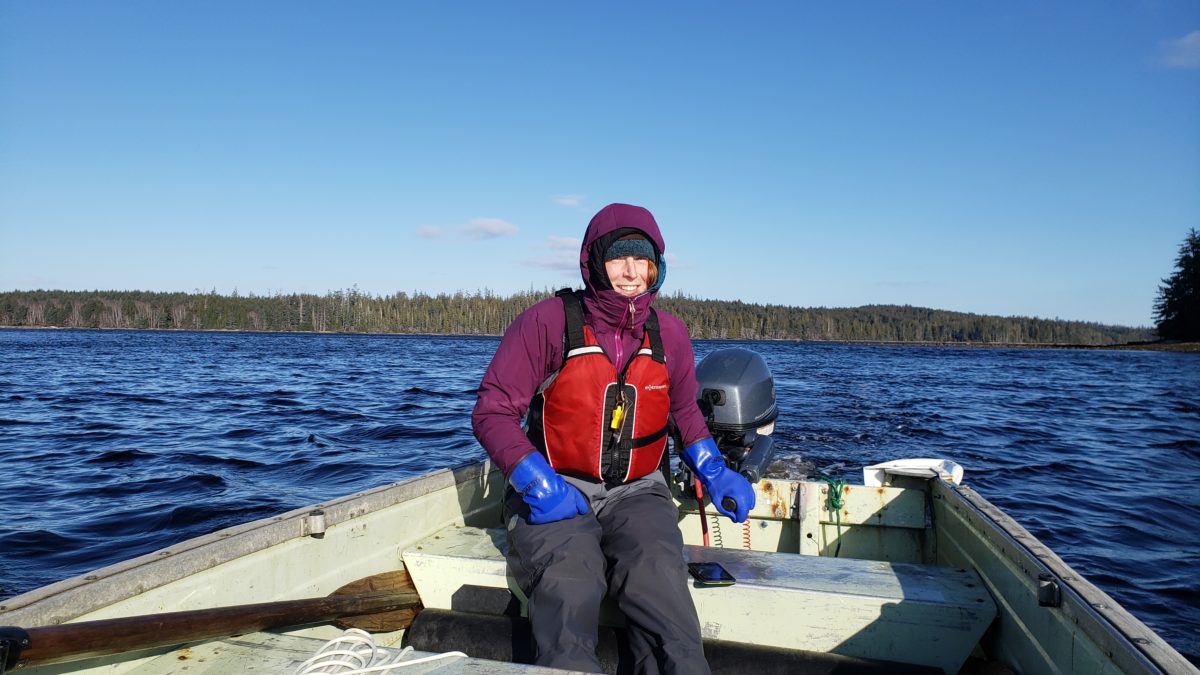
One of Sonja’s early project assignments took her to Haida Gwaii in early 2020 where she helped members of The Nature Trust’s senior crew install sophisticated data monitoring equipment in two estuaries. Following her return she sat down with The Nature Trust to share her experience and talk about the importance of the project.
We learned that we can’t take British Columbia’s coastal estuaries for granted and that their resilience has far reaching effects for the future of our Pacific salmon stocks.
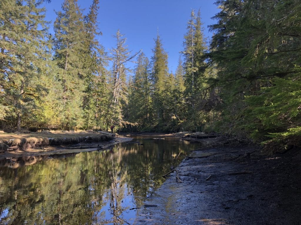
Kumdis River Estuary on Haida Gwaii
Which estuaries were part of this field trip?
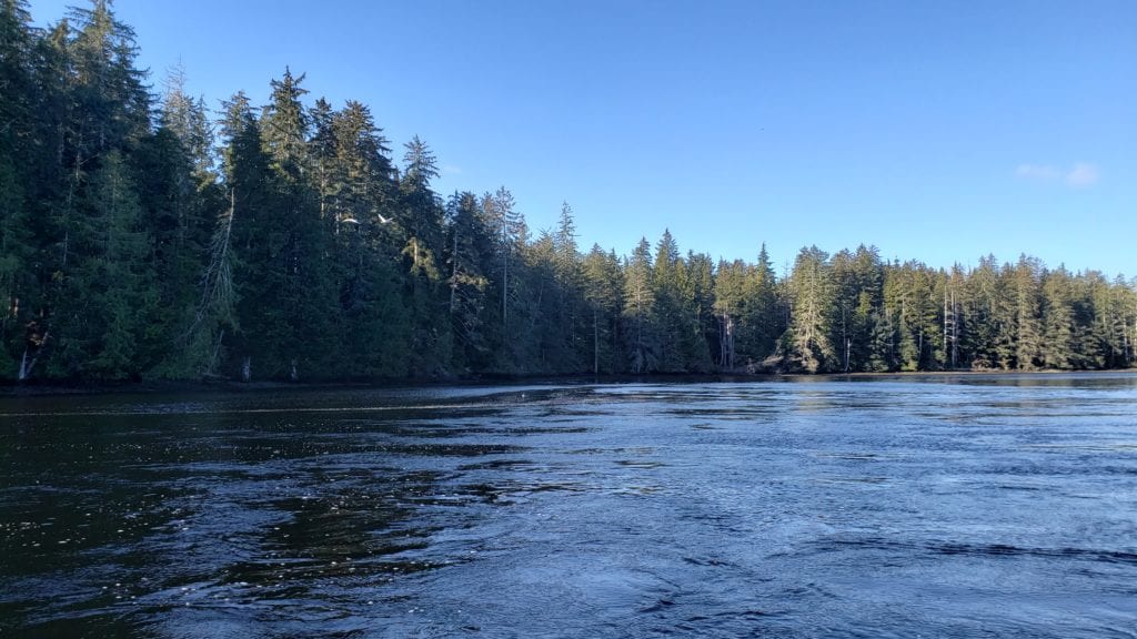
We worked in two estuaries, the Kumdis and the Naden. Both are amazingly beautiful places. The Kumdis estuary is near Port Clements on the shores of Masset Inlet in the middle of Graham Island. The Naden estuary, which is the larger of the two, is on the north end of Graham Island.
What was the focus of this trip?
The purpose of our trip was to install environmental monitoring equipment. One type of equipment was installed to measure the sediment accumulations. This equipment is hammered into the ground and stays there permanently, some are even drilled up to 15 metres into the ground. We also installed equipment underwater in tidal channels and at the mouth of the estuary to measure different water quality parameters, including temperature, salinity, depth and turbidity.
What kinds of data are you collecting?
There are many different metrics that we’re studying. One is sediment levels. Another is sea level rise and the gradient between fresh water and salt water. The vegetation that grows in the salt marsh has a very narrow band of elevation and if sea levels rise quickly it could flood them out. Vegetation is an important part of the habitat because it supports insects and other food sources for juvenile salmon. The shading effect of vegetation also helps keep water temperatures cool, which is necessary for salmon to reproduce and thrive.
What role do estuaries play in protecting Pacific Salmon?
Estuaries are basically a nursery for juvenile salmon. They spend up to a month in the estuary where brackish water helps them adjust so that they can move into the ocean and survive in saltwater.
Estuaries are very productive areas and a critical ecosystem for Pacific Salmon. The tidal channels provide important shelter for them and the water is deep enough to protect them from predators.
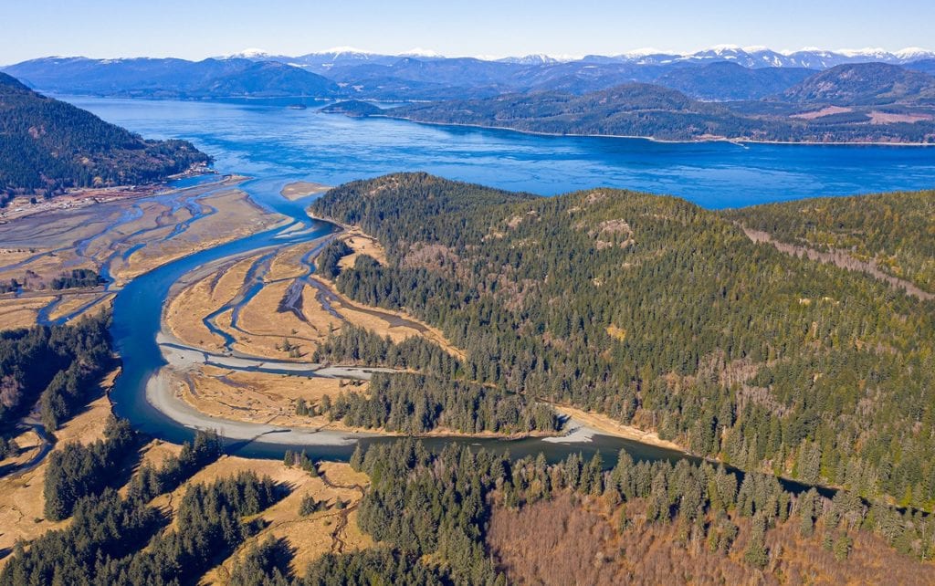
The Salmon River Estuary on Vancouver Island is one of The Nature Trust’s properties included in the Enhancing Estuary Resilience Project.
Were there any surprises or challenges?
The big unknown on this trip was installing equipment none of us had worked with before. We expected that to be a challenge. Some of the equipment had pipes and rods that are threaded together and allow for an installation up to 40 meters into the ground. Drilling continues until you hit rock. Fortunately, the installation went extremely well, and we hit rock at 18 meters.
One surprise was getting to use a demolition hammer and mix concrete. I had never done that before on a field trip but it was how we secured some of the posts.
What type of gear do you usually take on field trips?
When working in the estuaries I made sure to take chest waders because we are constantly in and out of the water. Otherwise, the equipment we carry varies depending on the tasks. We take satellite phones and inReach devices for safety in case of an emergency and we use cell phones for data collection. I wear a cruiser vest with pockets to hold tools because there’s always something to fix. I also take rain and boating gear and bear spray, depending on the time of the year.
Was there a memorable moment on this trip?
The first day in Naden was special because this estuary is in a remote area of Haida Gwaii, which few people get to see. To reach Naden, we took a spectacular boat ride up Masset Inlet. It was wonderful to see Masset from the water and to see Alaska on the horizon. From that perspective you appreciate the size of the Haida Gwaii archipelago.
I’ll also never forget the trip to Kumdis in our little skiff. The wind whipped up as we headed directly into the waves and despite our rain gear we all got completely soaked.
It was a fun day.
Kumdis River Estuary on Haida Gwaii
Did you have estuary field experience before this project?
Yes. Most of my previous field work was actually with birds, but mostly in marine and coastal ecosystems. I worked out of the East Limestone Island field station in Haida Gwaii conducting seabird and nesting bird surveys for The Laskeek Bay Conservation Society. I also worked on boat-access only streams on the Central coast, and I lived and worked out of a subarctic field camp in the Yukon-Kuskoswim River delta working on a Black Brant nesting colony.
I wanted to branch out because I like touching on different aspects of ecosystems and species. The estuaries in Haida Gwaii provide a wonderful opportunity to do that because their ecosystems are so varied.
Why is estuary work like this important to you?
Surveying estuary ecosystems is not only something I enjoy doing, it’s also important work. Estuaries and coastal wetlands comprise less than three per cent of B.C.’s coastline but support over 80 per cent of B.C.’s coastal fish and wildlife, including Pacific salmon.
The Salmon River Estuary on Vancouver Island is one of The Nature Trust’s properties included in the Enhancing Estuary Resilience Project.
Financial support for this project is provided under the BC Salmon Restoration and Innovation Fund, a contribution program funded jointly between Fisheries and Oceans Canada and the Province of BC.
This interview is the first in series of field report stories that The Nature Trust of BC will be sharing during the life the project. This interview has been edited for space and clarity.
The data from the equipment installed in the estuaries will inform the restoration phase of the project. Data will be fed into the Marsh Resilience to Sea-Level Rise (MARS) tool developed by the U.S. National Estuarine Research Reserve System to assess the estuary’s resilience and vulnerability. The Nature Trust of BC’s project is an extension of the research conducted in estuaries along the west coast of the United States and provides a Canadian context.